Friday, December 21, 2018

Expedition South Carolina Waters Exploring Charleston's Diverse Ecosystem And Habitats--Past And Present

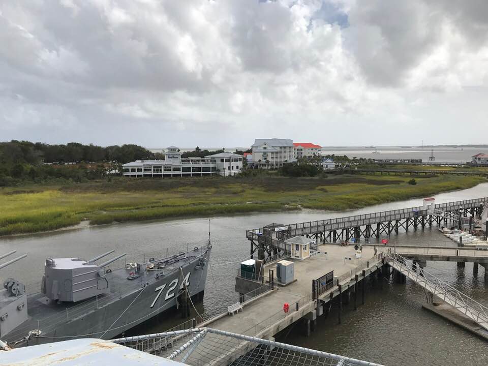
Caressed by the splendor of the rising sun and often threatened by the fury of the Atlantic Ocean, the picturesque and historic city of Charleston presides over her panorama like a queen. Resting on a peninsula cradled by the meandering currents of two merging tidal rivers, the vibrant and diverse downtown cosmopolitan and its welcoming deep water harbor are sheltered and sustained by a chain of barrier islands from Cape Romain to the ACE Basin. Some are inhabited and some are not. Some you can access by car and others only by some form of watercraft. Each of these delicately balanced islands are fringed by pristine, sandy beaches with stands of old, weatherworn oak, palmetto, magnolia and pine trees and linked to the mainland by a maze of verdant saltwater marshes and nutrient rich creeks. All of this natural grandeur makes Charleston a wonderland for water enthusiasts and camera toting naturalists.

Charleston's charismatic character has been molded over a long and illustrious history dating all the way back to the 1600's. Its rise to prominence was greatly influenced by the waters that saturated its diverse coastal topography from the average 5.5 foot saltwater marauder pouring into its estuaries twice a day from the Atlantic Ocean to the freshwater river systems flowing down from the state's upper Sand Hills.

Along its two major waterways, the Ashley and Santee-Cooper, visionaries manipulated their flow to ship goods and build sprawling rice plantations. These islands of affluent aristocracies and commerce would make Charleston the economic powerhouse on the eastern seaboard and a major shipping port, until the crushing affects of the disastrous Civil War squeezed the life out of their once glorious rice domains. Since, these river systems have been manipulated for another use, electricity, particularly the Santee-Cooper with the formation of Lake Moultrie and Lake Marion in 1939.

Today, on and within the Ashley and Santee-Cooper, remnants of a rich history remain for us to explore, absorb, and educate. But not only is it a treasure trove of history, it is an ecosystem filled with natural beauty and abundant wildlife imploring to be seen by all. With this thought in mind, a small group of Summerville resident scientists, photographers, and explorers headed by oceanographer Dave Eslinger are in the planning stages to accomplish this esteemed directive. The Expedition Team is reaching out to local schools and teachers to explore ways to make the accumulated data available for their use to benefit the students in their educational community.

Eslinger's Expedition South Carolina Waters, supported by a grant through the Open Explorer S.E.E. Initiative, have acquired a Remotely Operated Vehicle (ROV) called the Trident to assist in accomplishing the expedition's goals. The Trident will give the expedition team the ability to search and unlock by way of video photography the history and mysteries sealed below Charleston's rich waters. Along with the Trident, information will be acquired with the use of satellite documentation, drones, hand held cameras, and microscopy.

To begin, the expedition will concentrate on the Santee-Cooper waterway and eventually head up the Congaree River to Columbia, a one-time major transporting route which included the Old Santee Canal constructed in 1763--now submerged under Lake Moultrie. We invite you to follow the expedition's progress as the Team shares the imagery and information collected. In the meantime, the Team would appreciate your support by becoming a follower. You can sign up at National Geographic Expeditions South Carolina Waters and click on the FOLLOW tab. There, you can also read Dave Eslinger's bio and more expedition information. Thank you so much for your support and we look forward to sharing and hearing from you.

The Expedition Team: Dave Eslinger, Rick Olson, Adam Stover, Paul Zoeller, Brad Mallett, and myself.

Monday, December 17, 2018

"I am drawn to lighthouses like a wave is to the shore."--A day at the St. Augustine Lighthouse

Turning off A1A and entering the parking area of the St. Augustine Lighthouse and Maritime Museum, we were greeted by the sprawling tentacles of a thick stand of old oak trees. We entered the welcoming center and purchased our tickets. For the next hour or so, we toured the restored keeper's quarters and climbed the 219 cast iron steps with eight landings to the observation platform of the 165 foot tall lighthouse overlooking the oldest port in America. From there, we soaked in a breathtaking view of old St. Augustine's rich maritime landscape, converging waterways, and the far reaching temperamental Atlantic Ocean.


Discovered by Juan Ponce de Leon and established by Don Pedro Menendez de Aviles in the 1500's, St. Augustine's treacherous port had its beginnings under Spanish control, but almost became a French interest in its early years. With an established settlement called Fort Caroline near what is Jacksonville today, Jean Ribault threatened to take the Spanish settlement of St. Augustine with a heavily armed fleet of seven ships carrying one thousand French colonists and troops. In a preemptive strike aimed at thwarting Menéndez' plans to found St. Augustine, Ribault sailed his fleet southwards. Advantage was reversed when the fleet was struck by a hurricane which scattered and wrecked his ships between Matanzas Inlet and Cape Canaveral. Instead, Fort Caroline was taken, Ribault and his men put to the sword, and Spain established a firm grip over the frontier lands of Florida.

The Spanish built the first of a series of watchtowers for the fledgling port in the late 1500's. These early towers likely held a flame, as is indicated on several archival maps and documents. In time, St. Augustine came under British control in 1764, was returned to Spain after the American Revolutionary War in 1784, and then was ceded to the United states in 1819. Outfitted with a fourth-order Fresnal lens, Florida's American territorial government officially lit the first St. Augustine light in an existing coquina structure in May of 1824. Coquina is a tan-colored sedimentary rock formed when seashells and coral are glued together with calcite. At the outbreak of the American Civil War, Florida seceded the Union and joined the Confederacy, but St. Augustine was taken back by Northern troops in 1862 and the war finally ended in 1865.


With the coquina structure threatened by shoreline erosion, the US Congress appropriated $100K for a new tower. Construction began in 1871 and was completed in 1874. It was built with over a million Alabama bricks and Philadelphia iron works used to form the 219 stairs, 8 landings, observation decking and lens housing that crowned its top 165 feet above ground. A new hand-blown Fresnel lens, from Paris, France was installed and lit in October of 1874 by head keeper William Russell. The first-order Fresnel lens consists of 370 hand-cut glass prisms arranged in a beehive shape towering twelve feet tall and six feet in diameter. Today, the beacon is powered by a 1000 watt bulb and can be seen 19 to 25 miles out to sea. It remains one of only few such operating lenses in the United States.

The old tower succumbed to the sea during a storm in 1880. At this time retired Brev. Major William A. Harn of the United States Army was head keeper. Harn was at Fort Sumter when the first shelling began to open the Civil War and present at Appomattox when the Confederacy surrendered. He fought in most of the major battles of the Civil War including Gettysburg.


In 1876, a Victorian brick light keeper's house was added to the property, a triplex that held two families and a young, single, 2nd assistant keeper, most often of Menorcan descent. Brick summer kitchens were added in 1886. During World War II armed Coast guardsmen stood guard atop the tower, fixed jeeps in the 1836 garage and lived in a small barracks building. Light keepers' and their assistants lived and worked at the Light Station until the tower was automated in 1955.


The original light in 1874 was fueled by lard oil and then changed to kerosene in 1885. The kerosene was stored in four tanks with spigots in the oil room across from the keeper's office. To keep the light lit, the head keeper had to fill a five gallon bucket with the flammable liquid weighing about thirty pounds and carry it the grueling 219 steps to the lens room. A lighthouse operates like a clockworks keeping time as the lens turns around the light source. The keeper performed this strenuous task every 2 hours. Not only did he do this, but also his wife if he for some reason was not able.

As you climb the 219 cast iron stairs, there are 8 landings. Each landing features a wall history, recounting the stories of the Keeper's and their families. One amusing story you will discover on your ascent is about Cracker Daniels, the son of Light Keeper C.D. Daniels. Cracker Daniels "found out cat's can float when he attached a parachute to his sister's cat, Smokey and dropped him from the top the lighthouse. Smokey survived the descent, but the cat was very frightened and went missing for several weeks. Cracker's sister Wilma did not learn of this dastardly deed until 50 years later when he told her during a visit to the lighthouse."

The world’s first restoration of a Fresnel lens was accomplished at the St. Augustine lighthouse. After 19 of the first-order Fresnel lens's original prisms including one of three bull’s-eye panels had become damaged by a ricocheting vandal's rifle bullet, the USCG considered replacing the rare artifact with a modern airport beacon, which would be a huge historical loss for the lighthouse. The Junior Service League (JSL) of St. Augustine in cooperation with Chief Boatswains Mate Joe Cocking and Machinist Nick Johnston of the United States Coast Guard successfully pulled off the daunting task of repairing the lens and recorded the remarkable achievement.


St. Augustine and Charleston have shared histories. Toward the end of the Revolutionary War, thousands of loyalists fled from Charleston and Savannah to British held St. Augustine for safe refuge. St. Augustine's treacherous inlet claimed many of these refugee ships, including sixteen from the final fleet to evacuate Charleston in December 1782. Today, the Keeper's House is filled with artifacts salvaged from one of these shipwrecks together with two colonnade cast-iron cannons and two military buttons, including one from the 71st Regiment of the British Army dating 1780. The name of the ship has not yet been verified. Also, on August 31, 1886, the Charleston earthquake caused the tower to "sway violently", according to the keeper's log, but there was no recorded damage.


In 1936, electric light was installed in the lighthouse and the clockwork mechanism was replaced by an electric motor. The light had a candlepower of 20,000. Interestingly, in 1962, the brightest light in the United States belonged to Charleston Lighthouse also known as the Sullivan's Island Lighthouse. The beam was produced by six separate lights mounted on an aluminum base weighing 1800 pounds, The six lights produced an astonishing 28 million candlepower, which could be seen 70 miles out to sea. Since, due to complaints, it was reduced to 1.5 million candlepower and is visible for 26 miles on a clear night.

The Museum opened to the public full time in May of 1994. In 1998, it separately incorporated from the JSL as a community based museum with a non-profit, educational mission and a vision to become a distinguished center of maritime discovery. The Lighthouse Archaeological Maritime Program, Inc. (LAMP) was founded in 1999. LAMP archaeologists manage an active research program, surveying inland and offshore waters to discover new shipwrecks and other archaeological sites, and overseeing diving and excavation operations to investigate and monitor those already known. Many of the artifacts in the Keepers Quarters have been recovered by LAMP from the Storm Wreck project and it is ongoing.

Here are a couple of interesting events pulled from the lighthouse's time line. In 1861, the fourth-order lens in the coquina tower was darkened, removed, and buried in a secret location at the start of the Civil War to keep the Union from using it. The light was re-exhibited on June 1st, 1867. In 1874, flocks of ducks at night hit the new tower breaking window panes and chipping lens prisms. Netting was installed and keeper's feasted on duck.


I am drawn to lighthouses like a wave is to the shore. They are a fascinating part of an era that is long gone and only appreciated through what has been left for us to wonder and amaze. A time when the natural surroundings and civilization were one. Guardians of the coast, the Fresnel light beaming out from the lighthouse was a welcoming and lifesaving beacon to the stalwart mariner who had traveled long ocean distances from far away ports. Often built on some of the most foreboding landscapes and exposed to the harshest of seascape conditions, they were a symbol of solitary endurance as were the men and families who maintained their lights. The St. Augustine Lighthouse and Maritime Museum is worth a visit.

Ticket prices for St. Augustine Lighthouse and Museum Tour--Adults 12.95, Seniors 10.95, Children age 12 and under $10.95--Children MUST be 44 inches tall to climb the tower. Children under 44" tall receive free museum admission.

Tours--Sunset Moonrise Lighthouse Tour
Dark of the Moon Tour

Monday, November 5, 2018

One Of Charleston's Most Popular And Absorbing Tours--Patriots Point Naval And Maritime Museum

At one time, a monstrous steel behemoth prowling the Pacific high seas in the likeness of Herman Melville's Moby Dick, the USS Yorktown has long since its glory days been permanently anchored in the tidal sands of Patriots Point in Charleston. A floating military menace to the opposing forces of World War II, it is now a fascinating attraction that gives the ordinary citizen a glimpse into the military technology of the day and what life was like for those who manned its broad decks and armaments.

The USS Yorktown was the tenth aircraft carrier to serve in the United States Navy, commissioned on April 15, 1943. This Essex-class carrier was built in 16 1/2 months and renamed in honor of the Yorktown (CV-5) sunk at the epic Battle of Midway in 1942. It received the Presidential Unit Citation and earned 11 battle stars for its service from its commission date to the defeat of Japan in 1945.

Yorktown was modernized to operate jet aircraft as an attack carrier (CVA) in the 1950s, re-designated an anti-submarine aircraft carrier (CVS) in 1957, and later earned five battle stars for service off Vietnam from 1965-68. The ship also recovered the Apollo 8 astronauts and capsule in December of 1968 before being decommissioned in 1970.

Yorktown's displacement was over 27,000 tons and 872 feet in length at the time it was built. When upgraded in 1956, it increased to over 30,000 tons and 888 feet. As with all American carriers of the time, the Yorktown originally had a flight deck made of teak wood instead of armored plating, which gave the carrier greater striking power with more aircraft. Yorktown was towed from Bayonne, NJ to Charleston in 1975 to become the centerpiece of Patriots Point Naval and Maritime Museum, later joined by the destroyer USS Laffey in 1981 and the submarine USS Clamagore that same year. You enter the Patriots Point Naval and Maritime Museum at the Visitors Center through a turnstile, where there is a gift shop and ticket booths. Regular adult admission is $24, children 6-11 is $16, and senior tickets are $19.


I purchased my tickets and headed down a long walkway to where Yorktown was moored along with the Laffey. I then ascended wide steps to the large entrance leading into the ship's immense hangar deck where there was an information center flanked by historical displays and vintage aircraft running the length of the deck to the ship's theater at the end. You can choose several different tours. I was interested in checking out the new Engine Room Experience first and entered at the designated start point to begin my descent into the lower decks abyss. I descended steep steel ladder stairs with limited headroom to the deck where the galley was, along with medical quarters and rooms with dental chairs. I was greeted by an overwhelming pungent metallic diesel odor and wondered how anyone could get used to the inexorable noxious smell. Beyond the galley were the sleeping quarters with multilevel berths for a crew of almost 3,000.


After exploring this deck, I descended more steep confining latter stairs ducking my head so as not to bang it on the low steel beams to the lower decks and entered the glass doors to the new Engine Room Experience. The newly-renovated space used the latest technology to bring the story of the engine room to life and makes it easier for guests to understand the duties and purpose of this integral part of an aircraft carrier. It includes 15 unique halo-lit images, a virtual tour station of the lower decks of the engine room, a touchscreen kiosk using animation to explain how the engine of the USS Yorktown functions, and "holobox" scene showing a sailor lighting a boiler and another of him finding a steam leak--an unseeable danger to anyone who would walk into its path.


From the Engine Room Experience, I descended a series of steep ladders to reach the engine room. The pungent smell was beginning to affect me and exiting the lower decks was becoming mandatory, but I toughed it out to check out the massive boilers mounted with a plethora of valves and gauges. Satisfied, I quickly exited for the upper decks and fresh air.


My next move was ascending to the flight deck for a tour of the bridge, the command center, and air-traffic control--the strategic brains of the ship. On the flight deck were numerous aircraft, helicopters, and a stunning view of the surrounding Charleston landscape. It was breezy the day I stepped onto the flight deck, so hold onto your hat.


I ended my visit with a quick tour of the destroyer, USS Laffey--nicknamed 'The Ship That Would Not Die.' Two very absorbing features are the Combat Information Center and Mount 53. Upon entering the new CIC exhibit, a dual hologram appears and radar repeaters show a sweeping motion as they "search" for enemy submarines. Radio transmissions recreate one of the many tense moments from the Cold War. In the Mount 53 exhibit, you will take a step back in time to April 16, 1945 during an historic kamikaze attack and witness what it was like for the brave men serving in the gun mount. Entering the gun mount is challenging and the experience is very intense. I did not tour the Submarine. I will do that on my next visit.

Patriots Point has become one of South Carolina's most popular tourist attractions. It is informative, absorbing, and entertaining. Other attractions are the Vietnam Experience Exhibit, Medal of Honor Museum, and Flight Academy. Parking is $5 for the day.

Friday, October 12, 2018

An October Visit To The Once Upon A Time Wealthy Bleak Hall Plantation--Facts And Lore

Bleak House in the book
One of Dickens' finest novels, Bleak House was inspired by an actual court case in the English judicial system that dragged on for more than 50 years. It combines two tales: the story of wealthy Lady Dedlock and that of penniless Esther Summerson. The haughty noblewoman of Chesney Wold and the orphan housekeeper of Bleak House become entangled by the court case Jarndyce and Jarndyce, a mess of disputed wills and disrupted inheritance that has tied up the High Court of Chancery for decades. The story has a twist in it--Esther Summerson has a distinctive interconnection with Lady Dedlock, and I will leave it there.

There is some contention as to the real house that was the inspiration for the house in Dickens' story. A house located in Broadstairs, England, was a consideration. Dickens stayed with his family at this house (then called Fort House) for at least one month every summer from 1839 until 1851. However, there is no evidence that it formed the basis for Bleak House, particularly as it is so far from the location of the fictional house. The house sits on a cliff overlooking the town's waterfront on the Isle of Thanet. It was renamed Bleak House in honor of Dickens.


An 18th-century house located on Folly Lane in St Albans, Hertfordshire, the place where Dickens wrote some of the book, has also been identified as a possible candidate for the house in the story since the time of the book's publication and was known as Bleak House for many years.


Dickens' Bleak House story became a part of the Lowcountry's Sea Island history around the same time of its publication in 1852. In the late 1790's, a parcel of land located between today's Seabrook Island and Edisto Beach was being developed by Daniel Townsend III, who built a mansion on the property in 1805.

In 1842, his son, John Ferrars Townsend, inherited the plantation and became one of South Carolina's largest planters of Sea Island cotton. His cotton commanded a high price from lace-makers and won several prizes for both its quality and its length. Townsend was also a political leader serving in the South Carolina Senate, South Carolina House of Representatives. He attended the Secession Convention as a delegate and signed the Ordinance of Secession.

John Townsend was an admirer of Dickens. As a result, he was inspired to name his plantation after the house in Dickens' story with a slight difference, Bleak Hall. The original great mansion of Bleak Hall was two-and-a-half stories high on a raised basement. A distinguishing feature of the mansion, a cupola, was later added after the house was built so the homesick bride of one of the Townsends could look across the river to her former home on Wadmalaw Island. It towered over the surrounding oriental gardens and the now famous ice house, which still exists and is an outstanding example of Gothic revival architecture.

At the outset of the Civil War in 1861, by orders from the Confederate government, the steamboat "Beauregard" evacuated everyone from Edisto Island and the plantations. Both Confederate and Union troops used the cupola on Bleak Hall as a lookout. At the wars end, the plantations laid devastated. The valuable silver, china, and furniture that was left behind by the Townsends were carried away or destroyed by Freedmen and the Federals. When the Townsends returned in 1866, the house was occupied by former slaves. Shortly thereafter, it burned down. A new one was built in its place, but later torn down and a modern house was built nearby, which also disappeared in time.


Like all Southern plantations, legends abound. One involves a "bee hive well" called Jacob's well--a well surrounded by a wall of tabby with a steeple-shaped roof and the name "Jacobus Fecit" cut into one of its sides. In its early days, it was rumored to be a place where lovers secretly rendezvoused. It is believed a little gray man stands guard over the well to keep its waters pure and only allows the "pure in heart" drink from it.


Another story involves the plantation cemetery located at the fork in the road where you turn right to go to Bleak Hall or left to go to Sea Cloud--another plantation located nearby. After leaving a clearing, you enter a narrow road surrounded by dense undergrowth and trees. Here you will feel the first wave of hot air hit the back of your neck, then again and again until you leave the area. The slaves believed this hot air to be the "Hags breath" and if you linger, she will cast a terrible spell that could even cause your death.

A third legend speaks of a Portuguese man wearing large gold earrings and a red bandanna fashioned into a turban who roams the shores of Botany Bay. Seven of his victims were discovered on the beach--all of them standing straight up in the sand.


And then, there is the Mystery Tree. It is located at the entrance of the road that led to Bleak Hall and Sea Cloud Plantations. Those who have seen it are amused by the oddities that decorate its branches, which mysteriously change from time to time, but some believe it to be an object known to the Gullah culture as the bottle tree and its presence is a reminder of the evil that once was the scourge of human bondage during Bleak Hall and Sea Cloud's Antebellum period--believed to be the most notable, wealthiest and cruelest plantations in the South.

In the African culture, bottle trees are placed in a spot where evil is known to have dwelt. The tradition purports evil crawls into the bottles to destroy the beauty it reflects, becomes trapped, and is destroyed by the illumination of the rising sun. I have not seen bottles on the Mystery Tree, but symbolic or literal, this is what some believe as respects to its presence at the entrance of Botany Bay Road.

Today, Bleak Hall and Sea Cloud have been combined to form the Botany Bay Plantation--a wildlife preserve consisting of 3,373 acres. Formed in the 1930's by Dr. James Greenway, it got its name from the barrier island that was near, but not a part of the Bleak Hall property--Botany Bay Island. Some of the island's previous names were Tucker Island, Watch Island and Clark's Bay. The last owners, John and Margaret Meyer, deeded the property to the state.


Botany Bay Island was much larger in the early days of Bleak Hall Plantation--covered with an impenetrable tropical jungle of wild oaks, palmettos, and cedars just twenty yards from the shoreline. Over the years, the ocean has encroached on the land. Now, only a narrow, pristine strip of beach two miles long and lined with a sun-bleached bone yard of weatherworn dead timber remains--loved by photographers. It was separated from the large plantation by an inlet and a smaller island named "Porky," a shortened name from "Pour-quoi." While crossing the marsh to the beach, you will pass an outcropping of trees and plants called Hammock Island. The beach was significantly eroded by Hurricane Matthew and was closed for awhile, but has since opened.

Botany Bay Plantation is a magical place with a secluded beach unsurpassed on the Atlantic coast and located on Edisto Island not far from Edisto Beach. In fact, from Botany Bay's shell-covered beach you can see Edisto Beach to the right and Seabrook Island to the left.


You can take a tour of Botany Bay Plantation featuring 15 points of interest by car. Keep an eye out for the Portuguese man and do not linger near the cemetery if you feel a waft of hot air on the back of your neck.

Saturday, August 25, 2018

An Endangered Edisto National Historic Landmark With A Storied Past Is Rescued--Brick House Ruins

"I know not how it was--but, with the first glimpse of the building, a sense of insufferable gloom pervaded my spirit...I looked upon the scene before me--upon the mere house, and the simple landscape features of the domain--upon the bleak walls--upon the vacant eye-like windows--with an utter depression of soul which I can compare to no earthly sensation more properly than to the after-dream...Shaking off from my spirit what must have been a dream, I scanned more narrowly the real aspect of the building. Its principle feature seemed to be that of an excessive antiquity...Perhaps the eye of a scrutinizing observer might have discovered a barely perceptible fissure, which extending from the roof of the building in front, made its way down the wall in a zigzag direction, until it became lost in the sullen waters of the tarn."

The Lowcountry is rife with aged and ruined plantation homes that fit the portraiture of Edgar Allen Poe's "The Fall of the House of Usher." Once sprawling estates of opulence, now pillaged realms of providence--some by Federal troops in the Civil War--some by the all-consuming fires of unintentional carelessness--some by creeping disrepair. What Edgar Allen Poe described with trepidation, we idealize and romanticize. For us, they are living remnants of a glamorous and sometime savage by-gone time called the Old South. Their storied and ghostly pasts color our dreams and shade our nightmares--part of the wonder that lures people from all over the country and the world each year by the millions to their caretaker and master, Charleston and its Sea Islands. For me this particular day, the allure would take me to a Sea Island called Edisto.


Turning off of 174, after passing a few simple homesteads, it was a long drive up the unpaved sandy-stoned Brick House Road. It was lined on the left by old trees dripping with Spanish moss and cultivated farm fields on its right. At one point it split into two, until I arrived at an entrance marked by a ominously large no trespassing sign. I was going no further. The pictures I hoped to get of the old house beyond was not to be for I did not have an appointment and I was not going to dishonor the warning. The famous Brick House ruins was my intended objective.


Believed to have been built in 1725, Paul Hamilton used bricks imported from Boston and wood aged a minimum of seven years in its construction--Boston bricks were more denser than local bricks. It was architecturally designed in American colonial architecture, but flavored with a French Huguenot influence. The Jenkins family acquired the estate in 1798, which included the 300 acre plantation. It was in the late 1700's and early 1800's Sea Island plantations grew in wealth and prosperity due to its highly-prized Sea Island Cotton. It was around this time an Edgar Allen Poe type story became a part of its history. It is a story about a relative of Mrs. Jenkins named Amelia. If you would like to read the story go to The Lengendary "Brick House" on Edisto Island--A Love Story With A Regrettable Twist.


In 1929, a fire gutted the interior. The fire left only the exterior walls and its tall chimneys. The Brick House ruins have been slowly deteriorating and gradually overgrown with vegetation since. In the 1960s, the ruin's two chimneys were lowered by about 12 feet each to prevent them falling over, but the cracks and leans in the walls have gradually worsened. This National Historic Landmark and one of the Lowcountry's earliest, most substantial homes was nearing collapse and if that were to happen, an important piece of history would disappear into the dust pile of time. But fortunately, fate has turned in its favor.

In July of this year, the National Trust for Historic Preservation has come to the rescue. Two grants were provided to further the process of emergency stabilization and the much needed work was put in motion. Other proceeds have come from an oyster roast, the Historic Charleston Foundation, the Preservation Society of Charleston, The Rivers Foundation, and South State Bank. All told, the nonprofit has secured about $56,000 toward the current work, which is estimated at $70,000. Anyone who wishes can donate by clicking on this donation link.

Brick House is on private property and not open to the public. I hope to make arrangements at some point to photograph it for myself--This is an update to an earlier article.

Tuesday, August 21, 2018

"Next To Normal" Is A Next To Extraordinary Performance By The Flowertown Players

Considered "one of the best musicals of the 21st century and its soundtrack one of the best original soundtracks in a musical due to its graceful handling of its dark, complex subject matter and its moving and brutally honest exploration into pain," Next to Normal is next to gut wrenching and is presently showing at the James F. Dean Theatre Summerville.

A 2008 American rock musical with book and lyrics by Brian Yorkey and music by Tom Kitt, Next to Normal opened on Broadway in April 2009. It was nominated for eleven 2009 Tony Awards and won three: Best Original Score, Best Orchestration and Best Performance by a Leading Actress in a Musical for Alice Ripley. It also won the 2010 Pulitzer Prize for Drama, becoming the eighth musical in history to receive the honor.

What appears to be a seemingly normal household in suburban America is anything but. Within its walls lurks unrelenting family tragedies, a traumatized mother who struggles with the crippling effects of Bipolar Disorder, and a husband and daughter who are silently dealing with their own phantoms while dividing out time for doctors visits and medications. Despite all this, there remained a glimmer of hope, maybe not to be normal, but at least next to normal.


For Director Erik Brower, Next to Normal is personal having seen this kind of tragedy for himself with people he knew in college and you can see that personal touch in the passionate performances of the cast he brought together to portray this most difficult subject material.

Assisted by a live musical ensemble, Musical Director Kevin Thorn handled the musical score superbly. Alison Harvey(violin/synthesizer), Vanessa Chambers(cello), Megan Lamont(guitar), Josh Autrey(bass), David Carter(percussion), and Kevin Thorn(piano) didn't miss a beat.


The most capable cast poured their emotions out on the stage with powerfully moving performances and vocals. Sarah Daniel as Diana(mother) and David McLaughlin as Dan(father) fed off one another's heart wrenching portrayals with emotionally charged vocals. Allison Brower as Natalie and Johnathan Harper as Gabe(the brother) were equally gripping in their renderings. Impressively completing the full cast was Justin Borak as Henry(Natalie's boyfriend) and Carlos Nieto as Dr. Madden.


Set design, lighting, costumes, and choreography completed what was a top-notch presentation.


Next to Normal will be completing its run the 23rd to 26th. It is a next to extraordinary performance.
Purchase tickets.

Thursday, July 19, 2018

The Beautiful And Majestic Mount Rainier--Hiking The Skyline Trail Above Paradise

For the people who live in and around Seattle, its presence is unmistakable and its influence inescapable. It towers over its surrounding landscape and fills everyone living in its shadow with fascination and wonder each and everyday. In a cloudless sky, it is the first thing you see as you look toward the rising morning sun and the last as the day's light fades away below the Pacific horizon. This dazzling landmark is the beautiful and majestic Mount Rainier.

Majestic Mount Rainier soars almost 3 miles (14,410 feet) above sea level. It is located 59 miles south-southeast of Seattle in the Mount Rainier National Park. Each year almost two million visitors come to Mount Rainier National Park to admire the volcano and its glaciers, alpine meadows, and forested ridges. However, the volcano's beauty is deceptive. U.S. Geological Survey research shows that Mount Rainier is one of our Nation's most dangerous volcanoes.


Mount Rainier, an active stratovolcano currently at rest between eruptions, is the highest peak in the Cascade Range. Its edifice, capped by snow and 25 glaciers, has been built up by untold eruptions over the past 500,000 years. It last erupted in 1894-95, when small summit explosions were reported by observers in Seattle and Tacoma. Mount Rainier's next eruption might be of similar or larger size and could produce volcanic ash, lava flows, and avalanches of intensely hot rock and volcanic gases, called "pyroclastic flows."

The mountain was originally named Tahoma or "Great Snowy Peak" by the Yakima Indians. Captain George Vancouver renamed it after Admiral Peter Rainier of the British Navy during a scouting expedition on May 7, 1792. This name was hotly contested for over 100 years, because Americans felt it shouldn't be named after a British officer who had never even been to the U.S. An alliance of tribal members have moved forward with a proposal to restore an original name to this Northwest landmark, but a long bureaucratic process stands in its way. A Mount Rainier spokesman says the agency doesn't currently have a position and may not take one.


Mount Rainier's summit has an average high temperature of 33 degrees and an average low of 15 degrees in July, the month we visited. There is no mistaking when you enter Mount Rainier National Park--the Nisqually Entrance--a large log constructed sign marks the entrance where you pay a $30 fee which grants unlimited entry for one vehicle and passengers for seven consecutive days. Our planned destination was Paradise at approximately 5400 feet where there is a visitor center, the Paradise Inn, the Paradise Ranger Station and the 1920-built Guide House. Most of the parks 10,000-plus annual summit bound climbers begin their arduous and rewarding quest from this location. In 2015, 10,025 climbers made the attempt and only 4,888 were successful. It is also in Paradise where you will find some of the parks most popular hiking trails.

Before arriving at Paradise, we made a couple of stops along the way. The first stop was at Kautz Creek Trail for a beautiful view of Mount Rainier through the areas tall fir trees and the second at Narada Falls--a 176 foot falls located a mile from the Paradise area. After walking a descending path below the road, you are treated to a beautiful misty rainbow at its base where it plunges into a crystal clear pool.

The weather at Paradise was about 70 degrees and clear skies--perfect for climbing and viewing. With numerous trails to choose from, we selected the Skyline and Golden Gate Trails which ultimately took us to Panorama Point--a 4 mile trek with an 1700 foot elevation gain. Averaging 643 inches of snowfall per year, the trails were still covered with snow this early July. We walked over large slippery snow fields and climbed narrow, rocky ledges overlooking high cliffs with streams gushing past our feet. Along the way, we saw wild flower covered meadows and mountain goats clinging to rocky outcroppings. We were treated to stunning views of the summit and the sparkling Nisqually Glacier with numerous waterfalls crashing down its steep, craggy cliffs.


When we finally arrived at Panorama Point after hours of picture taking and gazing, we were standing above the cloud ladened peaks of the surrounding Tatoosh mountain range with Mount Adams shining in the sun far in the distance. Wispy clouds floated below us on the mountainscape from where we came. We took pictures and soaked in the inspirational and breathtaking scenes. In the meantime, a thick mist rolled in and covered the summit, which was no longer visible. It was time to leave. The mountain makes its own weather and we were about to experience that phenomenon.


As we descended the rocky trail, thick clouds began to surround us and visibility became almost zero. At this point, I had hiked ahead of Jared, my son, and Frank. I could no longer see them. The markers identifying the trails had disappeared and I lost my way on the snow fields looking for the foot tracks left by earlier climbers on our way up. I was becoming concerned. While on the snow, I came across an animal dressed in a coat of golden fur. Later, I would learn it was a marmot.

For a while, I appeared to be lost on the mountain, but luckily I found my way back onto the lower trails and the parking area where I waited for Jared and Frank. It was an exciting ending to a fantastic adventure with a lesson learned; you have to pay attention to the mountain because it changes in a blink of an eye.

For the strong, experienced hikers, who are prepared with the right clothing and equipment, route-finding skills, know their limits and when to turn around when conditions are unfavorable, the next stop from Panorama Point would be Camp Muir at 10,188 feet accessed via a junction across Pebble Creek--Camp Muir is the gateway to the south side of the summit by way of the Gibraltar Route.

Hiking the trails of Paradise on Mount Rainier is the ultimate and rewarding experience. It challenges you, inspires you, and humbles you. The beauty and splendor is unforgettable. Photographs capture a snippet in time, but it is an experience that can only be fully appreciated with your own eyes. If you are feeling a little whimsical, take a slide down one of the snow fields, climbers call it glissading. I appreciatively thank Jared and Frank for taking me on this rare and awe inspiring excursion on Mount Rainier.