There’s a place on Sullivan’s Island where the water narrows and the current quickens. It is a place where the Atlantic meets the Intracoastal, where tides collide and the sea decides who stays and who drifts away. It’s a place that doesn’t ask questions but somehow answers them anyway. The place is Breach Inlet.
I went there this morning, hoping for stillness. I brought a book I didn’t open and a Yeti of sweet tea I barely touched. The sky was a perfect blue, the kind that makes you forget anything could ever go wrong. But the inlet—it knows better. It’s seen too much to be fooled by the weather.
The sands here are never still. I have watched their transformation through the years. They shift with each tide, reshaping the shoreline like a restless artist never satisfied with the last sketch. One day there’s a crescent of beach wide enough to walk barefoot for hours; the next, it’s swallowed whole, replaced by a churning ribbon of water. Locals say the inlet has a memory, that it remembers storms and shipwrecks, and that it never forgets.
Out in the current, a pod of dolphins surfaced, their sleek backs catching the morning light. They moved with the tide, weaving through the eddies like dancers in a slow, ancient ballet. I watched them for a long time, their presence both playful and profound, as if they too were drawn to the mystery of this place.
And then there’s the new house on the point—glass and stucco, all clean lines and quiet luxury. It stands where the old house used to lean, weather-beaten and wise. The new place is beautiful, no doubt, but it hasn’t earned its stories yet. It hasn’t heard the wind howl through hurricane shutters or watched the moon rise over a sea turned silver. It’s still learning the language of the inlet.
On the drive over, just past Patriots Point, I saw something that stopped me cold. A woman walking hand in hand with a man. Her hair caught the light in a familiar way that took me by surprise. It was someone I once knew—someone I once hoped to know better. She didn’t see me. I didn’t stop. But the moment stayed. It appeared the ocean breeze was not blowing in my favor.
I sat in my car for a long time after that, watching the water shimmer like nothing had changed. But something had—not in the world—in me. There’s a quiet kind of sadness that comes when you realize a door you’d left open has quietly closed. No slam. No drama. Just the soft click of finality.
I walked the shoreline barefoot, letting the tide wash over my feet. The inlet curved ahead like a question mark, and I followed it—not looking for answers, just letting the water carry my thoughts. Some places feel like endings, even when they’re beautiful. And some people stay with you, even when they’re gone. I won’t write about that epiphany again—not directly. But she’ll be there: in the spaces between sentences, in the hush between tides, in the way the marsh holds its breath before the wind returns.
Breach Inlet doesn’t truly belong to anyone. It’s a threshold, a breath caught between tides. It is a place where the land exhales and the sea inhales, where endings blur into beginnings. If you sit with it long enough, in stillness and silence, it might whisper something you didn’t know you needed to hear. The current there has a mind of its own, often carrying you in directions you never intended. And when resistance feels futile, sometimes the only choice—the wisest one—is simply to let go and float.
Like the ocean tides, history has flowed in and out of Charleston Harbor since its inception. An inlet formed by the confluence of the Ashley and Cooper Rivers and a maze of wild-life-rich barrier islands. Yet, those same ocean tides reinforced by the power of the natural and unnatural order of things have now and again whipped up its shifting sands of time and rearranged the harbor's protective estuary islands, three in particular.
Once upon a time, Morris Island was actually three islands that stretched from Folly Island to Sullivan's Island. They were named Middle Bay Island, Morrison Island, and Cummings Point. In time, changing tidal currents altered the channel leading into Charleston and the three islands slowly merged into one and became just Morrison Island, later shortened to Morris.
The channel shifted once again. This time threatening Charleston Harbor, which could not be allowed to happen. Jetties were built to save the harbor, but the result caused severe erosion on Morris Island. The island shrunk. Testifying to that fact is the Morris Island Lighthouse. Once a proud guardian of the coastline, it has become a vanquished sentinel. Victimized by the shifting sands of time, the lighthouse address is now several hundred feet in the ocean. Yes, literally surrounded by the deep blue sea.
Presently uninhabited and undeveloped, Morris Island is a nesting ground for migrating birds and playground for visiting boaters looking for a place to relax on a sandy beach. Bathed by the relentless waves of the rising and falling tides off the Atlantic, it is also a great place to hunt for shark teeth and other fossils left on its shores.
With no road entry onto the island, tour companies like Coastal Expeditions make access available to all desiring to experience the splendor and natural amenities of this historically colorful barrier island of Charleston. For Coastal Expeditions Morris Island Shark Tooth Beach Drop, departure location was on Shem Creek where we were welcomed by a courteous and friendly staff who introduced us to our captain and first mate, (also the expedition's naturalist guide). After a few introductory words, we boarded Coastal Expedition's brand new Coast Guard-certified boat called Gannet. The captain's name was Al and Mike was the expedition guide for our 3 pm excursion.
We boarded the boat and were given some safety instructions. The captain fired up the boat's two Yamaha engines and eased away from the dock into the slow moving current of the creek. If you are likely to see bottlenose dolphins, Eastern brown pelicans, and the elusive manatee, it will be on this portion of the trip as you cruise past Shem Creek's premier restaurant mecca, a fleet of shrimp trollers, and out into the busy Charleston Harbor with its roughly 10 miles of coastal scenic beauty, which include unmatched views of the downtown skyline, Ravenel Bridge, Fort Sumter and other iconic landmarks.
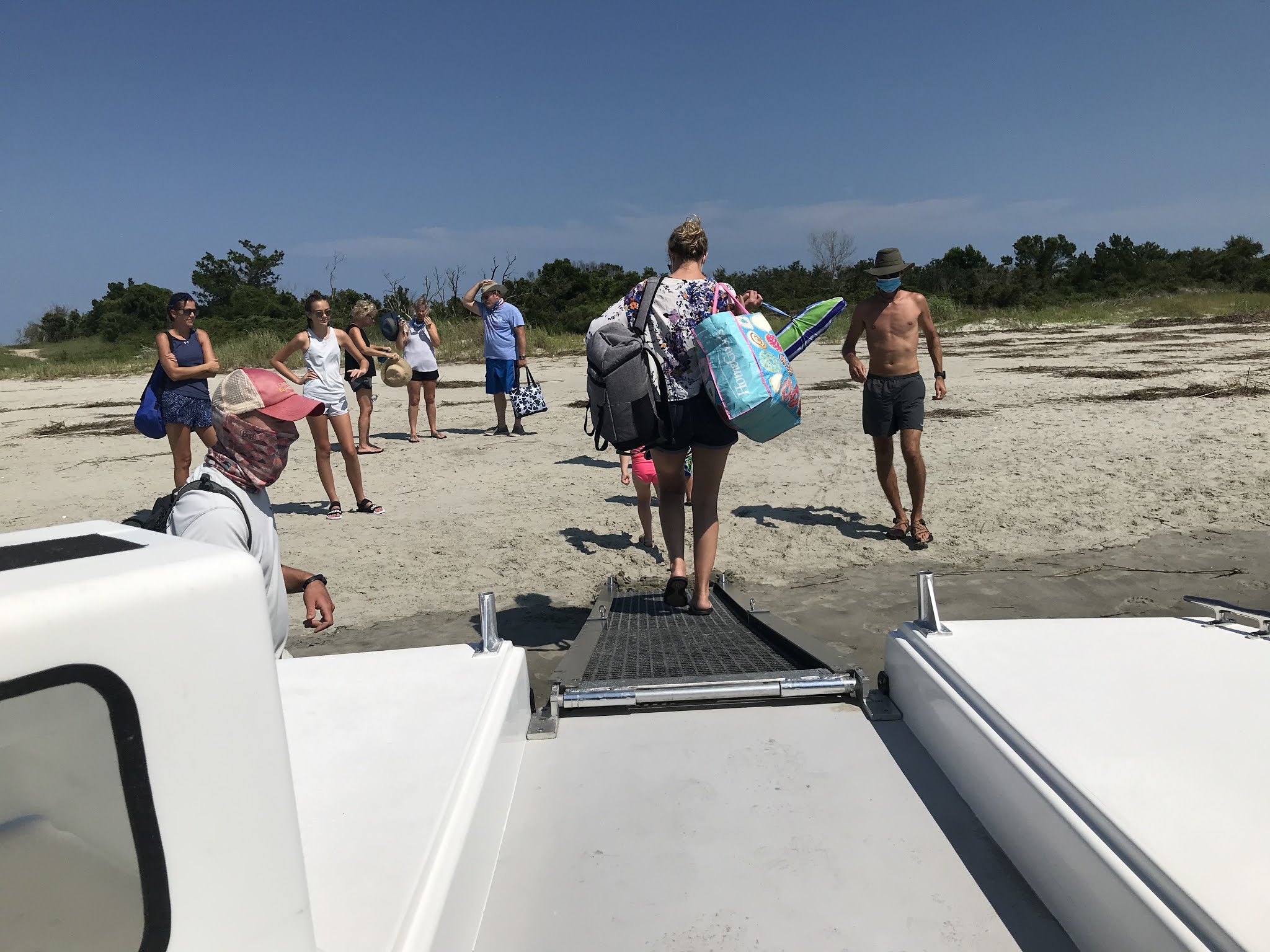
We put ashore on the harbor side of the island where the waters were calm and the scenery picturesque. The tours twelve participants disembarked. Some headed towards a sandy path cutting through the island's low growth vegetation while others gathered around the naturalist guide for tips on what fossils to look for and how to spot shark teeth on the beach. Afterwards, everyone made the trek up the path to the Atlantic side of the island where it entered onto a stretch of beach that abruptly ended at a massive granite rock wall.
The beach was covered with small shells of all sorts. At first glance, it seemed everything lying on or partially in the sand resembled the shape of a shark's tooth, especially the numerous shattered oyster shells. You had to assess very carefully each potential find, looking for specific characteristics like a serrated edge or the less shiny root.
At this time, my focus was not on searching through the shells for shark's teeth, but more on trekking to the rock wall to see what lay beyond. To my surprise, as I stepped over a rise beyond the point where the sand and the wall joined, there lay before me was the impressive beach of Morris Island with the lighthouse in the far distance. Rolling onto the island's gently sloping sandy shoreline, long traveling waves were ending their journey while seagalls filled the air with their piercing calls. Beach grass and low growing flowers covered the edges of the soft sands joined by groupings of palmetto trees standing above maritime salt shrub thicket bent in the direction of the prevailing ocean winds with the occasional solitary tree, some broken by tempestuous gales of past storms. It was a grand maritime forest panorama that extended the full length of the island's beach.
I spent most of the over three hours of the boat tour on the island's spacious beach beyond the granite wall simply enjoying the amenities of the sun soaked paradise taking pictures, dipping into the warm Atlantic waters, and searching for the cherished shark's teeth.
One of my questions for the naturalist was why the shark teeth we were finding had turned dark brown or black. He explained it this way. Shark teeth become preserved when they are buried. While buried, the teeth absorb the surrounding minerals as the calcium is replaced during its fossilization. The chemical composition of the sediments around Charleston tend to be darker, like the color of pluff mud. They are also very old. The process takes over 10,000 years. Some shark's teeth are millions of years old.
It was a quick three hours. Everyone met back at the drop-off point at 7 pm for the journey back. The sun was much lower in the sky. As we left Morris Island behind, the naturalist guide examined some of the findings and answered various questions posed to him by the group. We cruised past Fort Sumter and began to traverse Charleston Harbor. The spray from the splashing boat cutting through the water was refreshing. The captain paused for a moment near Sullivan's Island and shared some historical facts pertaining to Fort Moultrie and Charleston. After resuming, he explained some of the navigation signs of Charleston Harbor and added a bit of humor about one of the homes on Shem Creek.
The tour's captain was accommodating and professional. He handled the boat skillfully through the busy and sometimes rough waters of the harbor. Our naturalist guide and First Mate Mike was personable and knowledgeable. From beginning to end, he offered shark teeth hunting tips and made himself available to everyone who had a question, and I had plenty of questions as we bumped into each other from time to time on Morris Island's beautiful and impressive beach. Coastal Expeditions Morris Island Shark Tooth Beach Drop is well worth your consideration when looking for a boat tour for your family to a secluded Charleston beach on one of its uninhabited and undeveloped islands.
PRICE-ADULT: $50, CHILD: $35
TOUR DURATION: 5 hours (includes 30-min boat ecotour each way)
There were storms in the area, but from my experience, the sun always shines on the Isle of Palms. As I crossed the Daniel Island bridge, I could see the rain falling out over Charleston, but looking to the direction of the IOP my belief was confirmed--blue skies filled the horizon. I was traveling to the Isle of Palms Marina where I would board Barrier Island Eco Tours 49 passenger pontoon boat called the Caretta for a two and a half hour Dolphin Discovery Sunset Cruise to Capers Island. It was scheduled to leave dock at 6:00 pm.
Upon my arrival, I checked in at Eco Tour's booth, received my parking pass and picked up a couple of snacks to take on the cruise. Since it was 5:30 pm, I had an half hour to kill. While I awaited the signal to board, I sat on the red stained, wooden deck of the market and soaked in the late-afternoon marina atmosphere and humid, salty air of this popular backwater gathering place overlooking Morgan Creek. From the size of the gathering and awaiting crowd, it was going to be a full cruise.
As we boarded the Caretta, Captain Mike warmly greeted me and every person that crossed the gang plank. I took an outside seat along the rails for optimum picture taking and was joined by two other cruisers. The declining sun was still quit hot. As the boat gently rocked in the creek's ebbing current, the tour's naturalist, Sarah, welcomed everyone aboard. She delivered some opening words and ended the introductions with, "So, let's get the air conditioning going." With that said, Captain Mike fired up the engines and we eased away from the docks. The slight back water breeze and forward motion of the boat offered a welcomed cooling reprieve.
As we slowly motored in the no-wake zone, everyone on board one-by-one shared their places of origin with Germany the farthest. Sarah talked about the meaning of a tidal creek and how the level of Charleston's estuaries rise and lower on an average of six feet and added, "It does that twice in a twenty-four hour period."
Our first stop, after leaving the no-wake zone, was a nearby tributary where Sarah employed the assistance of the younger cruisers in pulling up some of Eco Tours' crab traps marked by floating buoys. Each of them enthusiastically took hold of the attached rope and dragged the trap on board. The first trap came up empty, except for two spade fish. It seemed the crabs discovered a way of escape through a damaged section of the cage to freedom. However, the second trap offered up the desired prize. She pointed out the various names people identify the captured crab by, but in South Carolina, it is known as the blue crab--a Charleston delicacy. After a few facts about It habits and identifying its sex, we headed to the open waters of a area called the Shark Hole--a deep hole, approximately 90 feet, scoured out by the constant current flowing in and out of the Atlantic channel between Dewees Island and the IOP.
Sarah asked what wildlife we hoped to see on our way to Capers Island, and of course dolphin, the bottlenose variety, was on top of the list. After all, this was a dolphin discovery cruise. She related some particulars about the dolphin. For example, South Carolina estuaries are the only place you can view the feeding frenzy called strand-feeding. One other interesting tidbit I learned from her informative narrative was that the dolphin is a highly protected marine species in South Carolina. You are not permitted to feed, catch, or hold a dolphin in captivity. Not even the South Carolina Aquarium display dolphins in their numerous exhibits. "In the wild, they are neither afraid of you or interested in you," she stated.
"Other wildlife you may see on our way to Capers is the loggerhead turtle, the opportunistic brown pelican--known for diving face first into the water to scoop up its dinner or patiently waiting for the dolphin to stir up some lunch, and a variety of other birds," Sarah informed. We scanned the sparkling waters for something to break the surface of the water. The boats expert dolphin-spotter named Hobbs, a mixed breed dog, alerted the group, but the sighting was brief. It was now time to leave the Shark Hole and head to Capers. With a thrust of the engines and spray of salty water in my face, we headed to the south-end of the island.
It was low tide. The sand that is usually covered by water was now exposed making the beach more expansive. The subtle rays of the declining sun washing over the island's sandy beachhead gave the terrain a soft glow. Not too far in the distance, the grayed timber of Boneyard Beach rose out of the sand like bleached skeletons left over from the age of the dinosaurs. The dead trees are a testimony to the Atlantic Ocean's relentless erosive power. I walked under their barren branches and photographed their fallen monarchs. The walk back to the Caretta was even more inspiring. Posing on the horizon, brushed over with the orange tint of the skylines changing evening palette, the darkened silhouette of the Caretta awaited our presence for a relaxing ride back to the Morgan Creek docks to the music and panorama of the living IOP estuary.
Unless you own a boat or know someone who does, some of Charleston's more secluded natural wonders are out of reach. Barrier Island Eco ToursDolphin Discovery Sunset Cruise to Capers offers you the opportunity to see one of them firsthand. The cruise aboard their Caretta is a relaxing evening jaunt to one of Charleston's most beguiling and picturesque barrier Islands. While you are enjoying the scenery, the naturalist on board shares with you their knowledge of what you are observing giving you a greater appreciation for the wildlife and the estuaries that make Charleston the number one destination in the world. Our naturalist for the evening delivered an informative presentation laced with a good balance of humor and included the younger ones in the activities. Somewhat disappointing, we did not see much in the way of dolphin activity. Possibly, it was the low tide, but that is the nature of things when it comes to wildlife in their natural habitats. It is a matter of timing. Capers Island did not disappoint. The low tide and setting sun enhanced the timeless beauty of the island's Boneyard Beach.
Offered Sunday-Friday from 6:00-8:30pm, Memorial Day through Labor Day.
Offered Sunday, Wednesday and Friday year round. Times vary with sunset.
$36 for adults, $26 for children 12 and under, 2 and under are free Purchase tickets
Barrier Island Eco-Tours
50 41st Avenue
Isle of Palms, SC
843-886-5000
Eagerly anticipating the arrival of this day, I woke to the sounds of the whelk singing in my ears and for this sort of occasion, the wished for weather was perfectly arranged--not by my hand. With a quick breakfast and implementation of the necessary preparations, I exited my home with camera in-hand and entered my heavily dew-covered truck. The anxious drive to my anticipated destination was marred with the typical nerve racking hustle and bustle of the early morning rush hour commute. Where I was going, such things are unheard of.
With only two minutes to spare, I arrived at the Isle of Palms Marina where the 49 passenger Caretta patiently awaited my presence--by now fully loaded with its precious sightseeing cargo. The last to board, I took a seat on the pontoon boat next to a couple from Murrells Inlet, David and Sharon, whom I bonded with on the excursion.
The Captain throttled the engine and we slowly pulled away from the weatherworn docks into the salty tidal waters of Morgan Creek. The high water marks on the wooden piles perched by pelicans and egrets indicated it was low tide. After entering the nutrient rich Intracoastal Waterway lined with boat docks and island homes, we steadily crept along the no wake zone and our tour guide began his enlightening narration.
Our first stop was an area in the Copahee Sound known to locals as the Shark Hole--a ninety foot deep backwater fish bowl scoured out by the surging tidal currents spilling through Dewees Inlet from the Atlantic Ocean. The open stretch of water is an excellent feeding ground for sharks and an ideal location for bottlenose dolphin sightings. The Captain's dog named Moses, a proficient dolphin spotter, barked wildly when he located a surfacing dolphin to alert the eager passengers attempting to get that one picture-perfect shot.
It was also an appropriate time for our barefooted guide to dispel the first of the many myths people have about marine life, such as, sharks and dolphins do hang out in close proximity to one another when feeding and yes, it is safe to swim in the ocean. Jessen rattled off a long list of things more deadly to us than sharks, like sticking a fork into a toaster or simply stepping off your porch. Mostly, it is a matter of mistaken identity.
After cruising the sun soaked waters of the inlet and satisfied we had seen all the dolphin we were going to see, Courtney accelerated the Caretta to top cruising speed and we headed toward the estuaries of Capers Island and our second stop, Eco Tours crab trap. The waterway was skirted by thick stands of salt grass, oyster mounds, and the occasional fallen tree. It was an idyllic time to absorb the peaceful beauty of the unspoiled surroundings.
With a buoy marking the location of the submerged crab trap now in sight, the captain brought the Caretta to a stop. The guide grabbed a long hook and with the assistance of some of the younger passengers, pulled it onto the deck of the boat. From the trap, he chose three specimens, two blue crabs and one stone crab. He spoke extensively about their habits and place in the estuaries diverse ecosystem. Holding up the blue crab, he asked, "How can you tell which one is the male and which is the female?" With a blue crab in each hand, he continued, "The male is marked by Washington's Monument and the female is marked by the dome of the Capitol Building." He paused and then revealed the punch line. With a grin, he continued, "Men go around doing monumental things, but we all know the female is in charge." Much of Jessen's narration was accented with well placed levity.
It was now time to move on to our final destination. At this point, a course change was made. Instead of proceeding to the southern tip of Capers Island, we headed for the northern tip through the winding and narrow Santee Pass to Price Inlet. With Bulls Island across the way and an eagle perched high above on a pole keeping a watchful eye, the Caretta slid onto the quietly tranquil sands of Capers Island and one by one we disembarked for an hour and a half self-guided exploration of the island.
With each step, the soft, water-soaked sand oozed through my toes and over my feet. I could feel and smell the fresh, salty island air as it encompassed me. Adding to the feeling of remoteness, I navigated around scattered piles of reddish-brown seaweed beached by the ocean's relentless waves. Undisturbed and protected, highly prized trinkets of the beachcomber bleached by the southern sun were randomly strewn about, among them the South Carolina lettered olive. A few pieces of old driftwood laid partially buried near where the sand met the grassy dunes and increased in frequency as I continued up the front beach towards the foremost reason I came to Caper's Island. About a half mile down the beach, I could faintly see the relics of past island erosion rising out of the intruding surf, shimmering in the bright sunlight--the monarchs of Bone-yard Beach. As I stood among the weathered and fallen wooded wonders, I was filled with a sense of fascination and awe. Seeing is believing and a picture truly paints a thousand colorful words.
A trip to Capers Island is like stepping back in time to an era before the colonizing tall ships of the early settlers came to this land and called their new home South Carolina. Barrier Island Eco Tours provides a relaxing and comfortable way to experience it, if you don't mind a little salt spray on a breezy day. Our naturalist guide and Captain for the excursion, Jessen and Courtney, were superb hosts. Jessen knowledgeably shared a balanced mix of information and humor that made it interesting and fun for young and old alike, Courtney handled the pontoon boat skillfully, and Moses kept eager little ones preoccupied. At $42 a person and children 12 and under $32, I highly recommend this tour for the whole family. You will come away with a greater appreciation and understanding for Charleston's versatile and delicate barrier island estuaries--a living wonder.