Showing posts with label Charleston lighthouses. Show all posts

Wednesday, August 12, 2020

Coastal Expeditions Morris Island Shark Tooth Beach Drop--Megalo-fun

Like the ocean tides, history has flowed in and out of Charleston Harbor since its inception. An inlet formed by the confluence of the Ashley and Cooper Rivers and a maze of wild-life-rich barrier islands. Yet, those same ocean tides reinforced by the power of the natural and unnatural order of things have now and again whipped up its shifting sands of time and rearranged the harbor's protective estuary islands, three in particular.

Once upon a time, Morris Island was actually three islands that stretched from Folly Island to Sullivan's Island. They were named Middle Bay Island, Morrison Island, and Cummings Point. In time, changing tidal currents altered the channel leading into Charleston and the three islands slowly merged into one and became just Morrison Island, later shortened to Morris.

The channel shifted once again. This time threatening Charleston Harbor, which could not be allowed to happen. Jetties were built to save the harbor, but the result caused severe erosion on Morris Island. The island shrunk. Testifying to that fact is the Morris Island Lighthouse. Once a proud guardian of the coastline, it has become a vanquished sentinel. Victimized by the shifting sands of time, the lighthouse address is now several hundred feet in the ocean. Yes, literally surrounded by the deep blue sea.

Presently uninhabited and undeveloped, Morris Island is a nesting ground for migrating birds and playground for visiting boaters looking for a place to relax on a sandy beach. Bathed by the relentless waves of the rising and falling tides off the Atlantic, it is also a great place to hunt for shark teeth and other fossils left on its shores.

With no road entry onto the island, tour companies like Coastal Expeditions make access available to all desiring to experience the splendor and natural amenities of this historically colorful barrier island of Charleston. For Coastal Expeditions Morris Island Shark Tooth Beach Drop, departure location was on Shem Creek where we were welcomed by a courteous and friendly staff who introduced us to our captain and first mate, (also the expedition's naturalist guide). After a few introductory words, we boarded Coastal Expedition's brand new Coast Guard-certified boat called Gannet. The captain's name was Al and Mike was the expedition guide for our 3 pm excursion. 

We boarded the boat and were given some safety instructions. The captain fired up the boat's two Yamaha engines and eased away from the dock into the slow moving current of the creek. If you are likely to see bottlenose dolphins, Eastern brown pelicans, and the elusive manatee, it will be on this portion of the trip as you cruise past Shem Creek's premier restaurant mecca, a fleet of shrimp trollers, and out into the busy Charleston Harbor with its roughly 10 miles of coastal scenic beauty, which include unmatched views of the downtown skyline, Ravenel Bridge, Fort Sumter and other iconic landmarks.


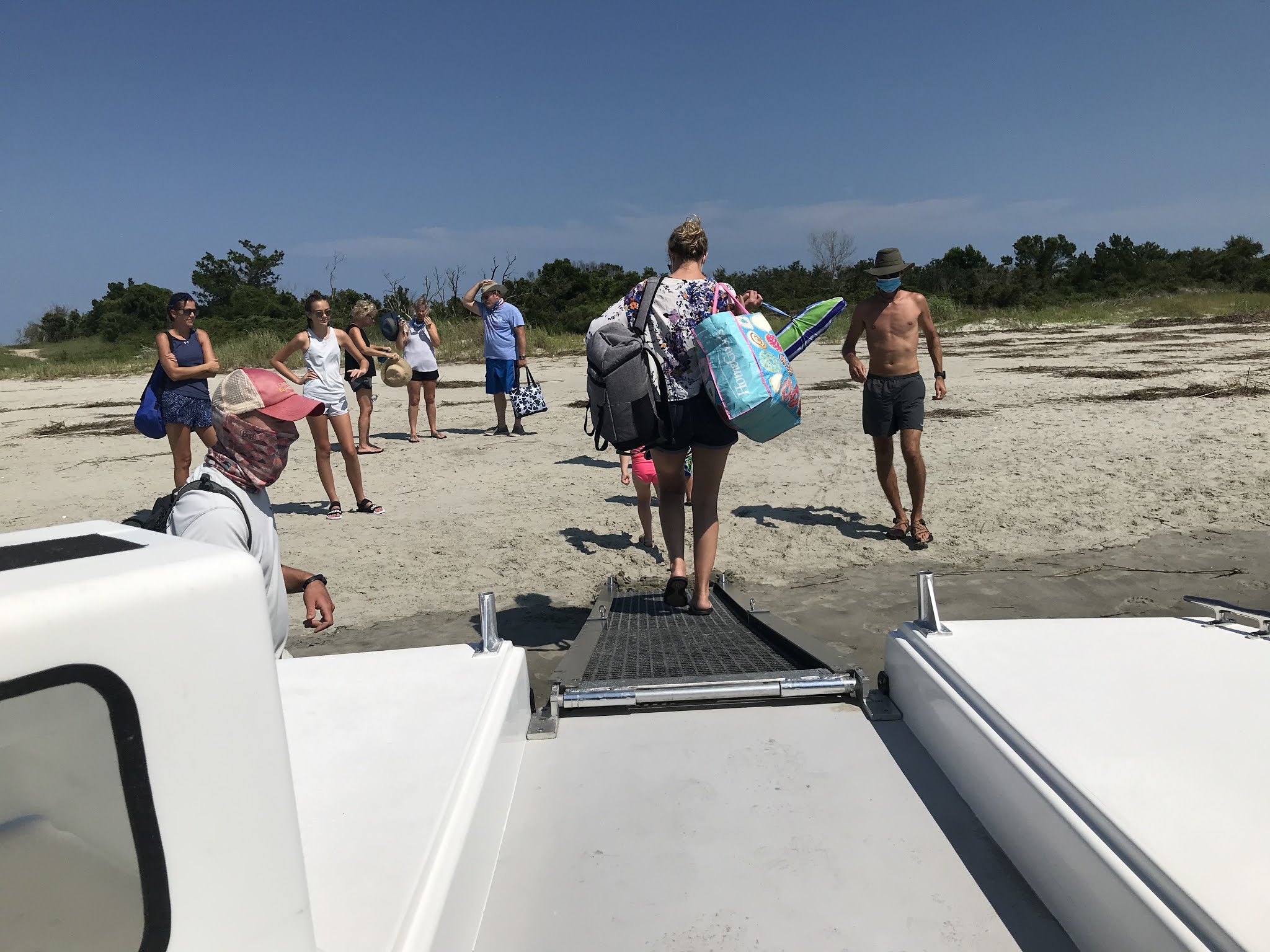
We put ashore on the harbor side of the island where the waters were calm and the scenery picturesque. The tours twelve participants disembarked. Some headed towards a sandy path cutting through the island's low growth vegetation while others gathered around the naturalist guide for tips on what fossils to look for and how to spot shark teeth on the beach. Afterwards, everyone made the trek up the path to the Atlantic side of the island where it entered onto a stretch of beach that abruptly ended at a massive granite rock wall.


The beach was covered with small shells of all sorts. At first glance, it seemed everything lying on or partially in the sand resembled the shape of a shark's tooth, especially the numerous shattered oyster shells. You had to assess very carefully each potential find, looking for specific characteristics like a serrated edge or the less shiny root. 

At this time, my focus was not on searching through the shells for shark's teeth, but more on trekking to the rock wall to see what lay beyond. To my surprise, as I stepped over a rise beyond the point where the sand and the wall joined, there lay before me was the impressive beach of Morris Island with the lighthouse in the far distance. Rolling onto the island's gently sloping sandy shoreline, long traveling waves were ending their journey while seagalls filled the air with their piercing calls. Beach grass and low growing flowers covered the edges of the soft sands joined by groupings of palmetto trees standing above maritime salt shrub thicket bent in the direction of the prevailing ocean winds with the occasional solitary tree, some broken by tempestuous gales of past storms. It was a grand maritime forest panorama that extended the full length of the island's beach.

I spent most of the over three hours of the boat tour on the island's spacious beach beyond the granite wall simply enjoying the amenities of the sun soaked paradise taking pictures, dipping into the warm Atlantic waters, and searching for the cherished shark's teeth.

One of my questions for the naturalist was why the shark teeth we were finding had turned dark brown or black. He explained it this way. Shark teeth become preserved when they are buried. While buried, the teeth absorb the surrounding minerals as the calcium is replaced during its fossilization. The chemical composition of the sediments around Charleston tend to be darker, like the color of pluff mud. They are also very old. The process takes over 10,000 years. Some shark's teeth are millions of years old.


It was a quick three hours. Everyone met back at the drop-off point at 7 pm for the journey back. The sun was much lower in the sky. As we left Morris Island behind, the naturalist guide examined some of the findings and answered various questions posed to him by the group. We cruised past Fort Sumter and began to traverse Charleston Harbor. The spray from the splashing boat cutting through the water was refreshing. The captain paused for a moment near Sullivan's Island and shared some historical facts pertaining to Fort Moultrie and Charleston. After resuming, he explained some of the navigation signs of Charleston Harbor and added a bit of humor about one of the homes on Shem Creek.


The tour's captain was accommodating and professional. He handled the boat skillfully through the busy and sometimes rough waters of the harbor. Our naturalist guide and First Mate Mike was personable and knowledgeable. From beginning to end, he offered shark teeth hunting tips and made himself available to everyone who had a question, and I had plenty of questions as we bumped into each other from time to time on Morris Island's beautiful and impressive beach. Coastal Expeditions Morris Island Shark Tooth Beach Drop is well worth your consideration when looking for a boat tour for your family to a secluded Charleston beach on one of its uninhabited and undeveloped islands.

PRICE-ADULT: $50, CHILD: $35

TOUR DURATION: 5 hours (includes 30-min boat ecotour each way)

514 Mill Street, Mount Pleasant, SC


Wednesday, July 19, 2017

Cape Romain Lighthouses Tour Hosted by Coastal Expeditions and the Sewee Center--Merging Historic Charisma with Beauty and Splendor

On Sunday, the adage "good things come to those who wait" was confirmed. For two years, I have been wanting to do the Cape Romain Lighthouses Tour, but for various reasons ranging from conflicting schedules to being sold out, the highly coveted opportunity had been as elusive as the red wolf. There are only four tours scheduled through the year and timing is everything. The next tour is scheduled for October. I almost did not make this one. It too was sold out. I had my name put on the waiting list in case there was a cancelation and as fate would have it, lightning struck. I am thinking the threat of thunderstorms forecasted for the day of the tour, which was July 16, may have presented me the necessary thunder. Thank you, Mother Nature.


Lighthouse Island is located in Cape Romain, a National Wilderness Area. Coastal Expeditions suggests participants wear appropriate footwear for water and pluff mud, preferably something waterproof and attached to your feet. Anyone experienced with stepping into the dark-brown viscous material knows losing your footwear is always a possibility. Since I do not own boots, and highly unlikely to wear them if they were available, my choice was between flip flops and tennis shoes. So, I put on the latter option, grabbed my camera and a banana for a snack, hopped into my truck and headed to the Sewee Center on Highway 17 in Awendaw for a pre-tour presentation.


Upon arrival, I checked in along with about forty other people for the hour-long slide presentation outlining the history of the two lighthouses on the island. It was delivered by Tom Graham, a College of Charleston grad with a degree in Biology. He has dedicated his time and energy for the past 20 years to the preservation and restoration of the lighthouses. The shorter conical lighthouse, standing 65 feet, was built in 1847 and the octagonal lighthouse, standing at 150 feet, was built in 1857. At the age of three, Tom was present when the 1857 light was taken out of service in 1947. The two lighthouses are the only structures left on the island, the light keeper's residences are just a pile of bricks and rubble.


From the Sewee Center, we headed for McClellanville and its boat landing on Pinckney Street where Coastal Expedition's Caretta Ferry awaited. Storm clouds were looming in the near distance to the south as forecasted.

Lighthouse Island is approximately a winding six-mile trip through the Cape Romain estuary from the boat landing. A smiling Captain William Christenson welcomed us aboard, gave us some necessary safety reminders, and the location of the life preservers. Then, he delivered his first of many humorous witticisms, "If you should happen to fall off the ferry, we will toss you the life ring, but truthfully, all you need to do is stand up. The water in the estuary is only about 3 to 5 feet deep at the most." For the next hour, Captain William talked about life in the estuary. He instructed, "Take a deep breath," paused and then added, "You are breathing the cleanest air in the world."


Cape Romain Refuge is a Class 1 Wilderness Area. It is a place where humans haven't developed roads, pipelines, or other industrial infrastructures. What we see today is pretty much what the Indians saw hundreds of years ago as they canoed through its winding waters. Besides supporting the cleanest air, it is home of the cleanest water in the world, and that is the result of the estuary's four necessary components: water, spartina grass, pluff mud, and oysters. Spartina grass is the only plant that can grow in the estuary's salty water due to its ability to filter the salt out of the water and secret the excess out through special glands.

The most thought-provoking part of Captain Will's narrative was when he talked about the estuary's most distinguished amphibious sojourner, the loggerhead turtle. Born on the sandy beaches of the estuary's barrier islands, the tiny hatchlings who survive their demanding and dangerous scamper to the water enter the ocean and spend the next thirty years in the Atlantic currents swimming the Gulf Stream to the North Atlantic Drift to the Canary Current to the North Equatorial Current and back to the Gulf Stream. Reaching maturity at age thirty, it returns to the beach it was born on and lays its eggs to continue the cycle of life and then returns to the currents. The odds of reaching maturity are 1 in 1000.


At the start, just a small silhouette in the distance, the white and black octagonal lighthouse was now a colossus rising high above the island's trees. The captain eased the Caretta into the spartina grass and the ramp was deployed. We waded through the ankle-deep water and traversed the bush-lined path to the lighthouses. For the next 45 minutes, I took pictures and walked among the brick strewn ruins of the keeper's houses. I touched one of the huge iron treads of the circular staircase now callous from rust and imagined ascending the 150 feet to the light room at the top--a task the light keeper performed daily. At present, imagine is all you can do, the light room at the top where the Fresnel lens was housed is off limits to the public for safety reasons. Possibly, within two years, you will be able enjoy a 360-degree panorama of the stunning surrounding vistas.


Lighthouses of old are remarkable relics of ingenuity and for many of us today, fascinating pieces of history and highly sought after subjects of photography. They were outwardly, geometrically simple in design, inwardly, an amalgamation of ingenuity all wrapped in a mystique as beguiling as an old grandfather clock. The Cape Romain Lighthouses Tour by Charleston Expeditions merges that historic charisma with the beauty and splendor of the Cape Romain estuary. The tour is both informative and entertaining thanks to the knowledgeable hosts. If you like boat rides, water, wildlife, and lighthouses, I highly recommend the Cape Romain Lighthouses Tour.


Departure Points:
Sewee Center
5821 Highway 17 North
Awendaw, SC

McClellanville Boat Landing (Boat)
Pinckney Street
McClellanville, SC